


















Lesson 52 of 54 · Projects and Practice
Meteorology glossary
A glossary of more than seventy key meteorology terms from the atmosphere, radiation, moisture, winds, fronts, storms, forecasting and climate, with short plain definitions.
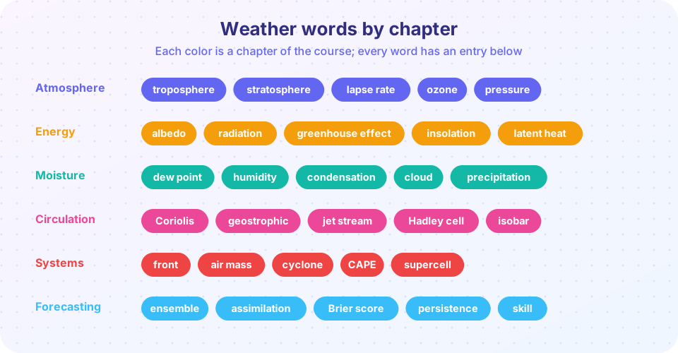
Every science has its own vocabulary, and meteorology has more than most. Some terms are everyday words used in a precise way (front, ridge, instability), some are borrowed (foehn, monsoon), and some are compact labels for a whole idea (CAPE, geostrophic). This glossary collects the key terms of the whole course in alphabetical order, with short definitions in plain language. Use it as a reference while you read other lessons, as a revision list before a test, or as a set of flashcards with the little tool below.
What you will learn
- Recognize and define the key terms of the course.
- Connect each term to the topic where it belongs.
- Test yourself with flashcards.
Key terms
Glossary entries are short on purpose. Each gives the core meaning and, where useful, a number or an example. For derivations and context, go back to the lesson on the topic. Terms such as front, air mass and CAPE appear in several chapters.
A to C
- Advection is the transport of a property, such as heat or moisture, by the wind.
- Air mass is a large body of air with fairly uniform temperature and moisture, shaped by its source region.
- Albedo is the fraction of incoming sunlight that a surface reflects; fresh snow has a high albedo and the open ocean a low one.
- Anticyclone is a region of high pressure with outward spiral winds; air sinks in its center and the weather is usually settled.
- Atmosphere is the layer of gases surrounding Earth, held by gravity; about 99 percent of its mass lies below 30 km.
- Barometer is an instrument that measures atmospheric pressure.
- Blizzard is a storm with strong wind (sustained or frequent gusts of at least 35 mph in the US definition), blowing snow and low visibility for at least three hours.
- CAPE (convective available potential energy) is the energy in J/kg available to a rising air parcel; large values mean strong updrafts are possible.
- Climate is the statistics of weather over a long period, usually 30 years.
- Cloud is a visible mass of tiny water droplets or ice crystals suspended in the air.
- Cold front is the leading edge of advancing cold air, a steep wedge that lifts warm air quickly.
- Condensation is the change of water vapor into liquid water, which releases latent heat.
- Convection is vertical motion in the atmosphere driven by buoyancy; it forms cumulus clouds and thunderstorms.
- Convergence is the flow of air toward a point or line; it forces air to rise.
- Coriolis effect is the apparent deflection of moving air caused by Earth's rotation, to the right in the Northern Hemisphere and to the left in the Southern.
- Cyclone is a region of low pressure with inward spiral winds; the word also names tropical storms in the Indian Ocean and South Pacific.
D to H
- Data assimilation is the blending of observations with a model forecast to create the starting state for the next forecast.
- Dew point is the temperature to which air must be cooled for it to become saturated; it measures the moisture content of the air.
- Divergence is the flow of air away from a point or line; aloft it removes mass and lowers surface pressure.
- Doppler radar is a radar that measures the motion of precipitation toward or away from it, giving wind information.
- Ensemble is a set of forecasts from slightly different starting states, used to estimate uncertainty and probabilities.
- Evaporation is the change of liquid water into vapor; it cools the surface.
- Eye is the calm, often clear center of a tropical cyclone.
- Eyewall is the ring of tall storms around the eye, where winds are strongest.
- Foehn is a warm, dry wind descending the lee side of a mountain range; the chinook is its North American form.
- Front is the sloping boundary between air masses of different density.
- Geostrophic wind is the wind in exact balance between the pressure gradient force and the Coriolis force; it blows along the isobars.
- Greenhouse effect is the warming of Earth's surface because gases such as water vapor and carbon dioxide absorb infrared radiation and re-emit it downward.
- Hadley cell is the tropical circulation in which air rises at the equator and sinks near 30° latitude.
- Heat index is the apparent temperature that combines air temperature and humidity.
- Humidity is the amount of water vapor in the air.
- Hurricane is a tropical cyclone with sustained winds of at least 64 knots (74 mph) in the Atlantic or eastern Pacific.
I to M
- Instability is a state in which a lifted air parcel becomes warmer than its surroundings and keeps rising.
- Isobar is a line on a map joining points of equal pressure.
- ITCZ (Intertropical Convergence Zone) is the belt near the equator where trade winds meet and air rises, forming a band of rain.
- Jet stream is a narrow band of fast wind near the tropopause, found above strong temperature contrasts.
- Lapse rate is the rate at which temperature decreases with height; the dry adiabatic rate is 9.8 K/km.
- Latent heat is the energy absorbed or released when water changes phase; condensation releases it.
- LCL (lifting condensation level) is the height at which a lifted parcel becomes saturated and forms cloud; about 125 m times the temperature-dew point spread.
- Mesocyclone is the rotating updraft of a supercell, a few kilometers across.
- Mixing ratio is the mass of water vapor per unit mass of dry air.
- Monsoon is a seasonal reversal of winds with a pronounced wet and dry season.
N to R
- Numerical weather prediction is forecasting by solving the equations of the atmosphere on a computer grid.
- Occluded front is a front formed when a cold front overtakes a warm front and lifts the warm air off the ground.
- Ozone is a molecule of three oxygen atoms; the stratospheric ozone layer absorbs harmful ultraviolet radiation.
- Parametrization is a simplified rule that represents processes too small for a model grid, such as convection.
- Persistence is the forecast that conditions will stay the same; a basic baseline.
- Precipitation is any form of water falling from clouds: rain, snow, sleet, freezing rain or hail.
- Pressure is force per unit area; atmospheric pressure equals the weight of the air above, about 1013 hPa at sea level.
- Pressure gradient force is the force that pushes air from high toward low pressure.
- Probability of precipitation (PoP) is the forecast chance of measurable rain at a place.
- Radiosonde is an instrument package carried by a balloon that measures pressure, temperature, humidity and wind aloft.
- Reflectivity is the strength of a radar echo from precipitation, in dBZ.
- Relative humidity is the ratio of actual vapor pressure to saturation vapor pressure, in percent.
- Return period is the average time between events of a given size; its inverse is the annual probability.
- Ridge is an elongated area of high pressure or high heights.
S to Z
- Saturation is the state in which air holds as much water vapor as it can at its temperature.
- Sea breeze is the wind from sea to land on a warm day, caused by uneven heating.
- Shear is the change of wind speed or direction with height or distance.
- Skill is the improvement of a forecast over a reference such as persistence or climatology.
- Sounding is a vertical profile of temperature, humidity and wind, usually from a radiosonde.
- Squall line is a line of thunderstorms, often ahead of a cold front.
- Stability is the tendency of air to resist vertical motion; stable air suppresses clouds.
- Storm surge is the rise of sea level pushed ashore by a storm, the main killer in tropical cyclones.
- Stratosphere is the layer above the troposphere where temperature increases with height; it contains the ozone layer.
- Supercell is a thunderstorm with a persistent rotating updraft; it produces the largest hail and strongest tornadoes.
- Teleconnection is a link between climate conditions in distant regions, such as ENSO.
- Thermocline is the layer in the ocean where temperature falls quickly with depth.
- Tornado is a violently rotating column of air in contact with the ground and a cloud base.
- Trade winds are the steady easterly surface winds of the tropics.
- Tropopause is the boundary between the troposphere and the stratosphere, at about 8 km near the poles and 16 km at the equator.
- Troposphere is the lowest layer of the atmosphere, where weather occurs and temperature falls with height.
- Trough is an elongated area of low pressure or low heights; fronts lie along troughs.
- Typhoon is a tropical cyclone with hurricane-strength winds in the northwestern Pacific.
- UTC is Coordinated Universal Time, the standard clock for meteorological observations.
- Verification is the measurement of how well forecasts matched what happened.
- Warm front is the leading edge of advancing warm air, which glides up a gentle slope over cold air.
- Westerlies are the prevailing mid-latitude winds from the west.
- Wind chill is the cooling effect of wind on exposed skin.
- Wind shear see Shear.
Try it
Use the flashcards to quiz yourself. Press "Show answer" to reveal the definition, then "Next" for a random card.
Press Run (or Ctrl + Enter) to see the console output here.
No output.
Common misconceptions
"Humidity and relative humidity are the same." Humidity is the amount of vapor in the air; relative humidity compares it with the maximum possible at the current temperature. "A cyclone is a tornado." A cyclone is a large low-pressure system hundreds of kilometers across; a tornado is a column a few hundred meters wide. "Weather and climate are interchangeable." Weather is the state now; climate is the long-term statistics.
Check your understanding
Quick check · 5 questions
of 5 answered You scored / 5 · perfect!
-
1. Which term describes the temperature at which air becomes saturated?
The dew point is the temperature to which air must be cooled for saturation. -
2. An isobar joins points of equal
Iso means equal and bar refers to pressure. -
3. The rotating updraft of a supercell is a
A mesocyclone is the rotating updraft a few kilometers across. -
4. Which term means the forecast that conditions will stay the same?
Persistence is the simplest baseline forecast. -
5. A ridge is
Ridges are extensions of high pressure; troughs are extensions of low pressure.
Summary
- Glossary terms are the shorthand of meteorology: learn them in groups by topic.
- Many terms come in pairs, such as ridge and trough, convergence and divergence, warm and cold front.
- Revisit the lesson of each term for its derivation and examples.
Next: Cheat sheet
Track your progress
Create a free account to tick off lessons and pick up where you left off on any device.
of Meteorology lessons completed