


















Lesson 33 of 54 · Air Masses, Fronts and Storms
Chapter review: Air masses, fronts and storms
Review chapter 6 of the meteorology course: air mass types, cold and warm fronts, mid-latitude cyclones and thunderstorms, with a recap table and a ten-question quiz.
This chapter followed a storm from its raw material to its end. Air masses supply the contrast, fronts mark where the contrast lives, cyclones organize it into rotating systems that cross oceans, and thunderstorms are the small, violent towers that appear wherever warm moist air is pushed upward. The poster below summarizes the whole chapter; the table and the quiz help you check what you remember.
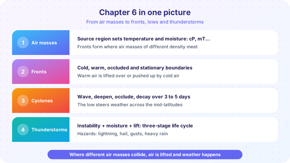
The chapter in one picture
Think of the chapter as a chain. A source region shapes an air mass. When air masses of different density meet, a front forms and air is lifted. If a wave develops on the front and the jet stream supports it, the system grows into a cyclone whose fronts sweep across continents. Wherever the lifted air is moist and unstable, a thunderstorm can grow. The same ingredients, moisture, instability and lift, show up again and again.
Recap table
| Topic | Key facts |
|---|---|
| Air mass | Uniform body of air, 1,000 km or more wide, shaped by its source region |
| Classification | c or m (moisture), A, P, T (temperature), k or w (colder or warmer than ground) |
| Typical types | cP cold and dry; mP cool and moist; cT hot and dry; mT warm and humid |
| Modification | Cold over warm: unstable, showers; warm over cold: stable, fog and stratus |
| Cold front | Steep slope 1:50 to 1:100, fast, narrow band of heavy showers, wind veers, cooler and drier behind |
| Warm front | Gentle slope about 1:200, slow, cirrus then thick stratus, steady rain, then warmer |
| Occluded front | Cold front overtakes warm front; warm air lifted off the ground |
| Cyclone stages | Stationary front, wave, open wave, occlusion, dissipation; 3 to 7 days |
| Deepening | Needs upper-level divergence to exceed surface convergence; bomb = 24 hPa in 24 h at 60° |
| Thunderstorm | Needs moisture, instability, lift; single cell lives 30 to 60 minutes |
| CAPE | Energy for a rising parcel, J/kg; theoretical updraft √(2 CAPE) |
| Lightning | Charge separation among ice particles; thunder about 3 s per km |
Try it
A parcel is absolutely stable if the environment cools more slowly with height than a moist parcel does, absolutely unstable if it cools faster than the dry rate, and conditionally unstable in between (the case that makes thunderstorms possible when something lifts the air high enough). The code below turns that rule into a small classifier.
Press Run (or Ctrl + Enter) to see the result here.
Program input · what you'd type while the program runs
Type the answers before you press Run, one per line. Each time the program reads a line (with input()), it gets the next line from this box.
Common misconceptions
"Fronts are just lines on a map." They are sloping surfaces between air masses of different density, and the lines mark where those surfaces meet the ground. "Thunderstorms only happen on cold fronts." They also form on hot afternoons without any front when instability, moisture and lift are present. "Cyclones are the same as hurricanes." Mid-latitude cyclones draw energy from temperature contrasts and have fronts; hurricanes are warm-core systems that get their energy from the ocean.
Check your understanding
Quick check · 10 questions
of 10 answered You scored / 10 · perfect!
-
1. Which air mass is cold and dry, often bringing clear, frosty weather in winter?
Continental polar air forms over cold land areas and is cold, dry and stable. -
2. Warm moist air moving over a cold surface becomes
Cooling from below stabilizes the air and condenses moisture into low cloud and fog. -
3. Which front has the steepest slope?
A cold front is a steep wedge, around 1:50 to 1:100, while a warm front is about 1:200. -
4. After a cold front passes in the Northern Hemisphere, you expect
The cold air behind the front brings lower temperature and dew point, a wind shift to the west or northwest, and rising pressure. -
5. The occluded stage of a cyclone happens when
The faster cold front catches the warm front and lifts the warm sector off the ground. -
6. In the cyclone life cycle the central pressure is usually lowest at
Deepening continues until the upper trough catches the low and the storm occludes, so pressure is lowest near that stage. -
7. At 60 N, a bomb cyclone deepens by at least
One bergeron at 60 degrees latitude is 24 hPa in 24 hours. -
8. Which is NOT required for a thunderstorm?
Moisture, instability and lift are the three ingredients. -
9. In a single-cell storm, the mature stage is when
Precipitation drags air down in the mature stage, producing a downdraft alongside the updraft. -
10. You see lightning and count 15 seconds to the thunder. The strike is about
Sound travels about 1 km every 3 seconds, so 15 seconds is about 5 km.
Summary
- Air masses are classified by moisture and temperature of their source region and are modified as they travel.
- Fronts separate air masses; cold fronts are steep and fast, warm fronts shallow and slow, occlusions combine both.
- Mid-latitude cyclones develop on fronts through five stages and deepen when upper-level divergence exceeds surface convergence.
- Thunderstorms need moisture, instability and lift, and organize into cells, clusters and squall lines.
- The next chapter turns these ideas into forecasts.
Track your progress
Create a free account to tick off lessons and pick up where you left off on any device.
of Meteorology lessons completed