


















Lesson 42 of 48 · Field Methods and Maps
Chapter 8 review: field methods and maps
Review topographic maps, strike and dip, geologic maps, cross sections and field notes with a chapter picture, recap table and a ten-question quiz.
You now have the field geologist's kit: how to read the shape of the land, how to measure the orientation of rock layers, how to read a geologic map and how to turn it into a cross section. This review brings the formulas and habits together.
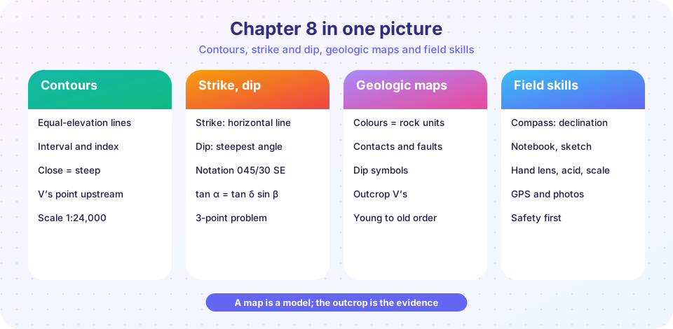
Recap table
| Topic | Key ideas | Formulas |
|---|---|---|
| Scale | Representative fraction, bar scale; large scale = small area | ground = map × denominator |
| Contours | Equal elevation; close = steep; V's point upstream | tan θ = interval / (spacing × scale) |
| Gradient | Rise over run; percent grade is not degrees | gradient = Δz / run |
| Vertical exaggeration | Stretches heights in profiles | VE = H denominator / V denominator |
| Strike and dip | Azimuth of level line; steepest angle; right-hand rule | dip direction = strike + 90° |
| Three-point problem | Three elevations fix a plane | fit z = ax + by + c |
| Outcrop and thickness | Gentle dip, wide outcrop | w = t / sin δ, t = w sin δ |
| Apparent dip | Oblique section shows gentler dip | tan α = tan δ sin β |
| Declination | Magnetic vs true north | true = magnetic + declination (E positive) |
| Field notes | Observation separate from interpretation; safety | none |
Where am I? What is here?
What does it mean?
How the pieces fit
The chapter is a pipeline from observation to model. A topographic map tells you where you are and what the land looks like. A compass-clinometer turns a tilted bed into two numbers, strike and dip. Those numbers, plotted on the topographic base, let you draw contacts and a geologic map. The map becomes a cross section when you project dips downward. Finally, your notebook records the evidence behind every step. Each stage has a formula or rule that keeps it honest: scale, contour spacing, the right-hand rule, outcrop width, apparent dip and declination.
A worked mini-problem
A sandstone bed crops out in a band 120 m wide on level ground, measured across the strike. Its dip is 20°. The true thickness is t = 120 × sin 20° = 41 m. A cross section drawn along a line that makes 35° with the strike would show an apparent dip of arctan(tan 20° × sin 35°) = arctan(0.364 × 0.574) = arctan(0.209) = 11.8°. If you had drawn 20° on that section, the bed would look too steep. Both results come from the same two relations, and both are easy to check.
Common exam traps
- Confusing a large scale with a large area.
- Reading closer contours as higher ground.
- Giving a dip as a direction instead of an angle.
- Forgetting the declination correction.
- Drawing a section oblique to the strike without converting the dip.
- Writing interpretations into the observation column of a field note.
When you meet a new map problem, start by asking what you are given (scale, interval, strike, dip, thickness) and what you are asked for, then pick the one relation from the table that connects them.
Try it
Press Run (or Ctrl + Enter) to see the result here.
Program input · what you'd type while the program runs
Type the answers before you press Run, one per line. Each time the program reads a line (with input()), it gets the next line from this box.
Press Run (or Ctrl + Enter) to see the console output here.
No output.
Check your understanding
Quick check · 10 questions
of 10 answered You scored / 10 · perfect!
-
1. On a 1:24,000 map, 3 cm is how far on the ground?
3 × 24,000 = 72,000 cm = 720 m. -
2. Contour lines that are very close together indicate:
Close lines mean a big elevation change over a short distance. -
3. Which map has the smallest scale?
1/1,000,000 is the smallest fraction. -
4. A bed dips 25° toward 200°. By the right-hand rule its strike is:
Strike = dip direction − 90° = 110°. -
5. A 40 m thick bed dips 10°. Its outcrop on flat ground is about:
w = 40 / sin 10° ≈ 230 m. -
6. An apparent dip is always:
tan α = tan δ sin β, and sin β ≤ 1. -
7. On a geologic map, the unit at the center of an eroded syncline is:
Beds dip toward the axis of a syncline, and the youngest rock is in the core. -
8. Declination is:
It must be applied to compass readings to get true azimuths. -
9. A gradient of 100 percent is a slope angle of:
100 percent means rise equals run, which is 45°. -
10. Which is the best field-notebook practice?
Observations written on the spot are the evidence behind interpretations.
Summary
- Scale, contours and gradient turn a topographic map into numbers.
- Strike, dip, outcrop width and apparent dip describe tilted layers and connect maps to sections.
- A good geologist separates observation from interpretation, corrects for declination and works safely.
- Next come case studies, a project, practice problems and a glossary that bring the chapters together.
Track your progress
Create a free account to tick off lessons and pick up where you left off on any device.
of Geology lessons completed