


















Lesson 15 of 43 · Land Use and Zoning
Chapter 3 Review: Land Use and Zoning
Review chapter 3: density and FAR, land value and bid-rent, how zoning works, mixed use and TOD. A recap table, one-picture summary and a ten-question quiz.
Chapter 3 covered the rules and the economics that decide what gets built where. Use this page to check that you can do the calculations, read a zoning rule and explain the main ideas aloud.
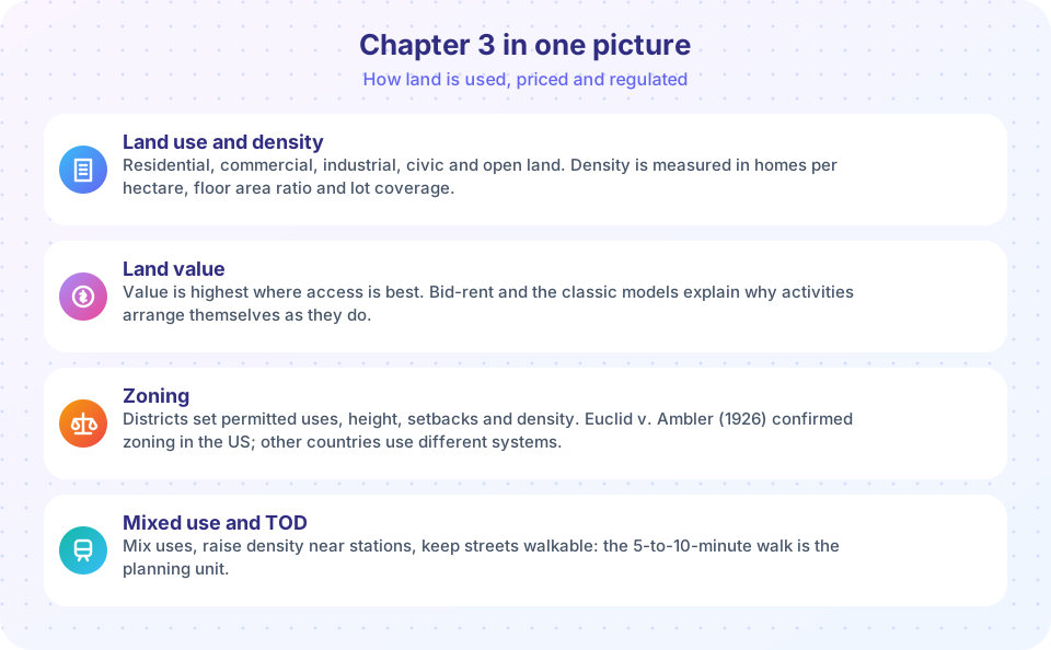
Recap table
| Topic | Remember |
|---|---|
| Density | Dwelling units per hectare, FAR, lot coverage; net versus gross |
| FAR | Floor area divided by lot area; FAR x lot = maximum floor area |
| Land value | Highest where access is best; bid-rent explains the pattern (Alonso, 1964) |
| City models | Burgess (1925) rings, Hoyt (1939) sectors, Harris and Ullman (1945) nuclei |
| Zoning basis | Police power; Euclid v. Ambler (1926) |
| Code parts | Districts and map, use rules, dimensional standards, supplementary rules |
| Permissions | As of right, conditional use, variance, rezoning, nonconforming |
| Systems | Rules-based (US), discretionary (England), national menu (Japan), no zoning (Houston) |
| Mixed use | Shorter trips, longer street hours, compatible uses only |
| TOD | Density and mix near stations; 400 m about 5 min, 800 m about 10 min |
| Form-based codes | Regulate building form and frontage; transect |
| 15-minute city | Access to daily needs within about 15 minutes on foot or by bike |
Worked review problems
- A 1,500 m² lot has FAR 2.4. Maximum floor area = 1,500 × 2.4 = 3,600 m². At 90 m² per unit and 85 percent efficiency, that is 3,600 × 0.85 / 90 = 34 homes, a density of 34 / 0.15 = about 227 homes per hectare.
- A building covering 30 percent of its lot is permitted to reach FAR 1.5. Its average height in storeys is FAR / coverage = 1.5 / 0.3 = 5 storeys.
- A street network has circuity 1.4. A 10-minute walk covers about 833 m of street, so the straight-line reach is 833 / 1.4 = about 595 m.
Try it
Practice with flashcards on the vocabulary of this chapter. Click a card to flip it.
Check your understanding
Quick check · 10 questions
of 10 answered You scored / 10 · perfect!
-
1. A 800 m2 lot has FAR 1.5. What is the maximum floor area?
800 x 1.5 = 1,200 m2. -
2. Which concept explains why retail clusters in the center while housing spreads outward?
Retailers bid more for central land, with steeper bid-rent curves, so they win the center. -
3. Which model describes wedge-shaped zones along transport routes?
Hoyt's 1939 sector model shows similar uses extending along routes. -
4. Which is a conditional use?
Conditional uses need a hearing or permit and may carry conditions. -
5. Roughly how far is a 10-minute walk at 5 km/h?
5 km/h is about 83 m per minute, so 10 minutes is about 830 m. -
6. A form-based code mostly regulates:
It uses diagrams and standards for height, frontage and entrances. -
7. Which of the following is NOT a typical zoning reform?
Reforms generally loosen restrictions that limit housing; larger minimum lots tighten them. -
8. Who proposed the concentric zone model in 1925?
Ernest Burgess based it on Chicago. -
9. Net density differs from gross density because net density:
Net density is measured over the building lots only, so it is higher than gross density. -
10. Which is a limit of TOD evidence?
People who like transit may choose to live near it, so not all the effect is caused by the place.
Summary
- Density, FAR and coverage translate zoning numbers into homes and jobs.
- Land value follows access, and bid-rent explains the city's pattern.
- Zoning codes combine a map, use rules, dimensional standards and procedures; systems and reforms vary.
- Mixed use, TOD, form-based codes and the 15-minute city are the modern answers to car-dependent separation.
Track your progress
Create a free account to tick off lessons and pick up where you left off on any device.
of Urban Planning lessons completed