


















Lesson 41 of 43 · Projects and Practice
Glossary of urban planning terms
A plain-language glossary of 40 urban planning terms from housing, streets, parks, resilience and planning practice, with flashcards for quick revision.
Planning has a vocabulary of its own, and many terms sound like everyday words while meaning something precise. This glossary collects the key terms from the housing, public space, sustainability and practice chapters in alphabetical order. Use it to check a definition, then test yourself with the flashcards below.
What you will learn
- Recall precise definitions of the chapter's key terms.
- Distinguish terms that are often confused, such as mitigation and adaptation.
- Use the flashcards to practice recall.
Key terms
Glossary: an alphabetical list of terms with short definitions.
Flashcard: a prompt on one side and an answer on the other, used for active recall.
Active recall: testing yourself instead of rereading, which strengthens memory.
The glossary
Accessory dwelling unit (ADU): a small, separate home on the same lot as a larger home, such as a backyard cottage or basement apartment.
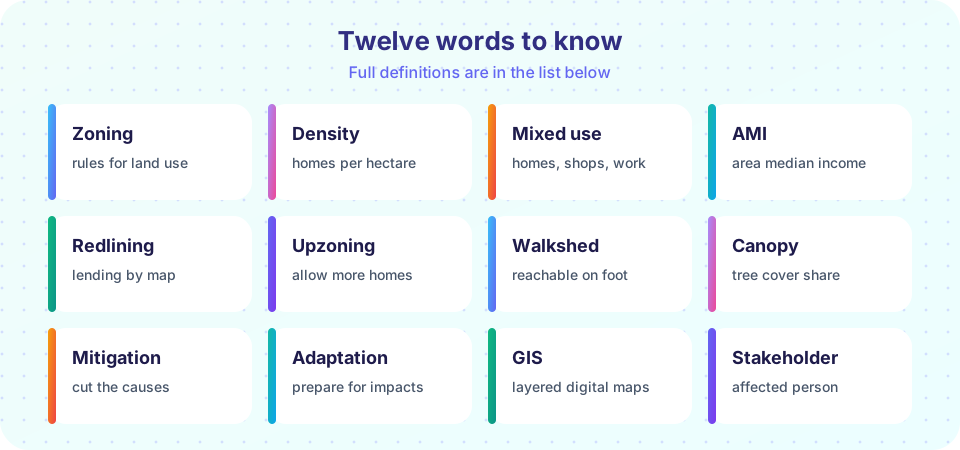
Adaptation: actions that reduce harm from climate impacts that are already happening or unavoidable.
Area median income (AMI): the income at which half of a region's households earn more and half earn less; used to set eligibility and rents for affordable housing.
Annual exceedance probability: the chance in any one year that an event of a given size or larger occurs; 1 percent for a "100-year flood."
Buffer: in GIS, a zone at a set distance around a feature.
Canopy: the layer of tree leaves and branches covering the ground when seen from above, measured as a share of land area.
Charrette: an intensive, collaborative design workshop.
Co-benefit: a side benefit of a measure designed for another purpose, such as street trees that shade sidewalks and also absorb stormwater.
Community land trust: a non-profit that owns land and keeps the homes on it permanently affordable.
Complete street: a street designed for all users and ages, including walkers, cyclists, transit riders and drivers.
Comprehensive plan: a long-range plan guiding a city's land use, transport, housing and services.
Cost burden: spending more than 30 percent of gross income on housing; severe cost burden is more than 50 percent.
Density: the number of people or homes per unit of land area.
Dissimilarity index: a measure from 0 to 1 of how unevenly two groups are spread across areas.
Embodied carbon: greenhouse gas emissions from producing and transporting building materials.
Exposure: the people and property located where a hazard can strike.
Filtering: the gradual drop in a home's price relative to others as it ages.
Floor area ratio (FAR): total floor area of buildings divided by the area of the lot.
GIS: geographic information system; software and methods for analyzing data tied to places.
Green infrastructure: natural and semi-natural features, such as street trees and rain gardens, that provide services like cooling and stormwater control.
Hazard: a physical event that could cause harm, such as a flood or heat wave.
Human scale: proportions and distances that fit the human body and walking pace.
Inclusionary zoning: a rule requiring or encouraging below-market homes in new developments.
Indicator: a measurable number used to track progress toward a goal.
Mitigation: actions that reduce greenhouse gas emissions.
Mixed use: a mix of homes, shops, workplaces and services in the same area or building.
NIMBY and YIMBY: "not in my back yard" and "yes in my back yard"; shorthand for opposing or supporting nearby development.
Participatory budgeting: a process in which residents decide how to spend part of a public budget.
Redlining: denying or limiting loans and insurance in neighborhoods, historically on the basis of the race or ethnicity of residents.
Resilience: the ability to absorb shocks, adapt and recover.
Runoff: rainwater flowing over land surfaces instead of soaking in.
Stakeholder: anyone affected by, or able to affect, a decision.
Superblock: a group of blocks with through traffic kept to the edges and the inside streets given to people.
Transit-oriented development: compact, mixed-use development within walking distance of frequent transit.
Upzoning: changing rules to allow more homes or more intense development on land.
Urban form: the physical pattern of a city: density, street layout and land uses.
Urban heat island: warmer temperatures in built-up areas than in surrounding countryside.
Vulnerability: how likely people or assets are to be harmed, depending on resources, health and support.
Walkshed: the area reachable on foot within a set time or distance.
Zoning: local rules that divide land into districts and regulate what can be built and how it can be used.
Try it
Flip through the flashcards. Click a card to reveal the definition, then mark whether you knew it.
Check your understanding
Quick check · 4 questions
of 4 answered You scored / 4 · perfect!
-
1. Which term means actions that reduce greenhouse gas emissions?
Mitigation addresses causes; adaptation addresses impacts. -
2. What does the dissimilarity index measure?
It ranges from 0 (even) to 1 (fully separate). -
3. A walkshed is
Planners map walksheds to see who can reach services on foot. -
4. Which pair is correctly defined?
FAR compares total floor area with lot area.
Summary
- Planning terms are precise; learn them with their definitions.
- Pair similar terms (mitigation and adaptation) to avoid confusion.
- Flashcards turn the glossary into active recall.
Next: Cheat sheet
Track your progress
Create a free account to tick off lessons and pick up where you left off on any device.
of Urban Planning lessons completed