


















Lesson 11 of 43 · Land Use and Zoning
Land Use and Zoning: Overview
A roadmap to chapter 3: how land is used, why land has value, how density is measured, how zoning works and how mixed-use and transit-oriented planning change the rules.
Walk down any street and you pass a series of invisible decisions. This lot is a house, the next one a shop, and the large one beyond the fence is a school. Behind each choice are two forces: what the land is worth to different users, and the rules the city has written about what is allowed. Land use planning is the work of understanding both and steering them toward a city that works.
This chapter explains how land is classified and measured, why land has the value it does, how zoning turns plans into legal rules, and how newer ideas such as mixed-use districts and transit-oriented development rewrite the traditional approach.
What you will learn
- The main categories of land use and why cities separate or mix them.
- How the chapter's three lessons fit together.
- The vocabulary you will need: density, floor area ratio, setback, district.
The big picture
Land is not like other goods. It cannot be moved, its supply in a given place is fixed, and its value depends on what is around it. A plot beside a rail station is worth more than an identical plot ten kilometers away because more people want to be near the station. Economists call this the importance of location, and it is the starting point for understanding why cities look the way they do.
Land use is a negotiation between markets and rules. In the absence of rules, owners would use land for whatever pays best, which can produce conflict: a smelter next to a school, or a tall tower blocking a neighbor's windows. Rules, mainly zoning, set boundaries. But rules can also overreach, locking in low density where demand for homes is high and pushing up prices. Finding the balance is one of the great debates in modern planning.
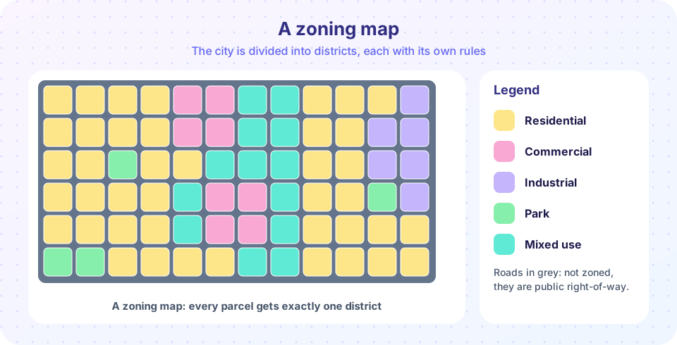
Density and form matter as much as use. Two districts may both be "residential" and look completely different: a street of detached houses with gardens, or a street of five-storey apartment buildings. Planners therefore measure density and describe building form, not just use.
Categories of land use
How land is measured
Tools
Roadmap of the chapter
- Density and land value. How to measure density, how to compute floor area ratio, and why land prices form the pattern we see, from von Thunen and Alonso to the classic models of urban structure.
- How zoning works. The legal basis, district types, dimensional standards, permits and variances, and how zoning differs between countries.
- Mixed use and transit-oriented development. Jacobs's conditions, the walkable neighborhood, form-based codes, the 15-minute city and station-area planning.
- Chapter 3 review. A recap and a ten-question quiz.
Why this matters
Land use rules touch almost every issue in later chapters. Housing costs depend on how much homes can be built. Travel patterns depend on how far apart homes, jobs and shops are. Climate goals depend on whether buildings are compact and efficient. Equity depends on who gets to live in which neighborhoods. If you can read a zoning map and calculate a floor area ratio, you can understand the main constraints on any development proposal near you.
Try it
This quick classifier lets you click a land use and see which categories it usually falls in. Rules vary by city; this is a typical, simplified scheme.
Check your understanding
Quick check · 3 questions
of 3 answered You scored / 3 · perfect!
-
1. Why is a plot beside a rail station usually worth more than an identical plot far away?
Land value depends mainly on location: nearer to many customers, workers and services means higher demand. -
2. Two residential districts can differ greatly even with the same use. Which measure tells them apart?
Density and building form (height, coverage, style) describe how intensively land is used. -
3. Which lesson in this chapter introduces floor area ratio?
Density measures, including FAR, are introduced in the density and land value lesson.
Summary
- Land use plans balance what land is worth to users with the rules a city sets.
- Land is classified (residential, commercial, industrial, civic, open) and measured (density, FAR, setbacks).
- Chapter 3 covers density and land value, zoning, mixed use and transit-oriented development.
Next: Density and Land Value
Track your progress
Create a free account to tick off lessons and pick up where you left off on any device.
of Urban Planning lessons completed